Oregon - Washington - California
Founder
Services
Founder
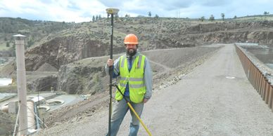
John K. Lucey, PLS (OR, WA, CA) has been a land surveyor for over 25 years. He received a Bachelor of Science in Geology from the College of William and Mary in 1997. He and his family have called Bend home since 2003 and if he’s not outside surveying, then he’s outside skiing, exploring or golfing.
Clients
Services
Founder

The strength of our land surveying company is the diversity of our clients. Not everyone needs a land surveyor every day, but when they do, it’s important to find one who has the experience to help guide their project. From individuals wondering where to build a fence to major utilities needing inspections of their facilities, Axis provides accurate and efficient results. Axis has worked with hundreds of individual property owners in Central Oregon and thanks them all!
Current and Recent Clients include:
The Nature Conservancy https://www.nature.org/en-us/
Solterra Capital
Sister City
Guerrilla Development
Pacwest Builders https://www.pacwesthomes.com/
Services
Services
Services
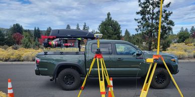
Topographic Mapping
Boundary Surveys
ALTA Surveys
Land Partitions and Subdivisions
Property Line Adjustments
FEMA Flood Plain Certificates
Construction Staking


